Boatie v5
Your sailing companion app – the yachtsman’s all-rounder
Version 5 is a major version update (released August 2022) – re-written from the ground up to take advantage of the latest Apple frameworks, and to provide a solid foundation to ensure continued updates well into the future.
What’s New?
- A full UI Refresh to be responsive to all screen sizes – now also supports ‘Dark Mode’ and support for iOS/iPadOS 16.
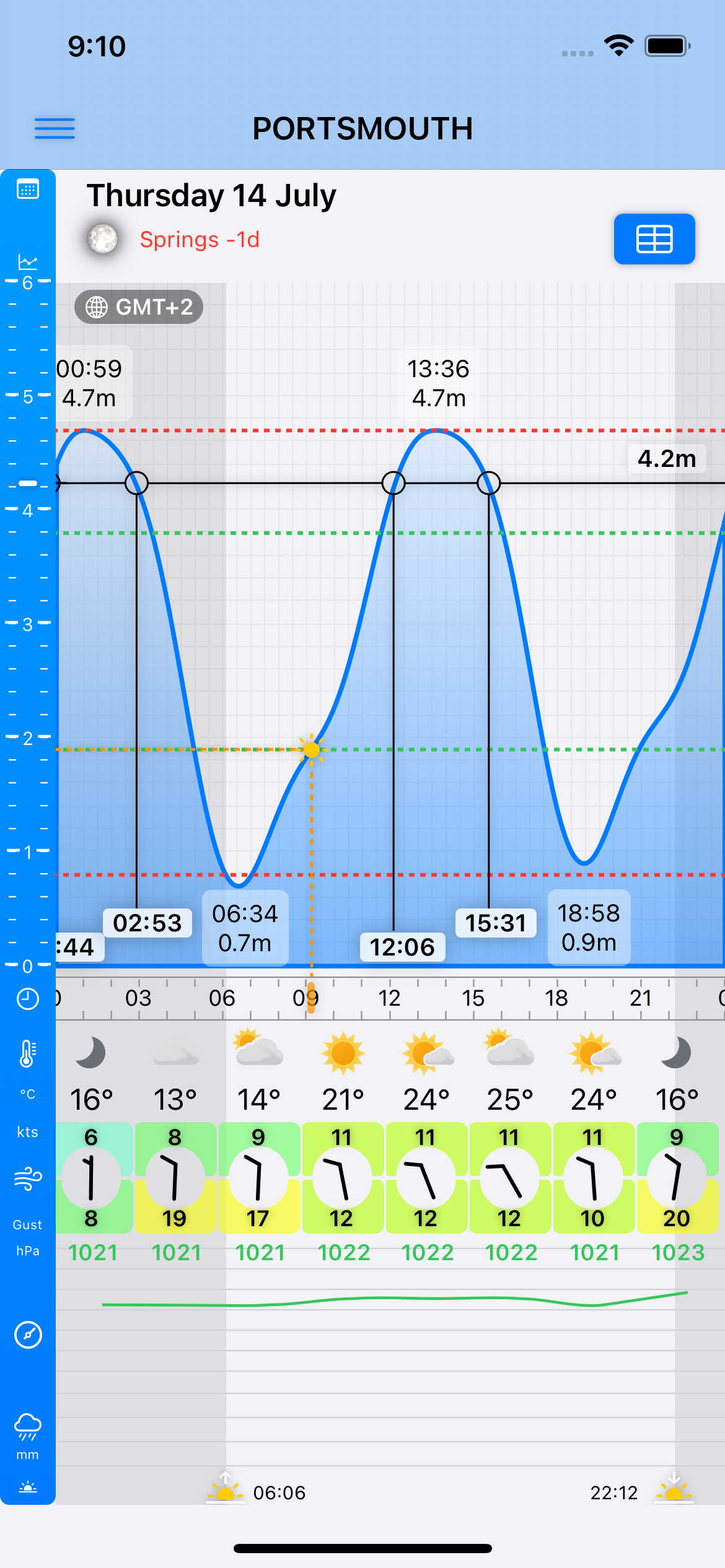
- Tidal predictions and weather forecasts are now available for over 750 primary and secondary ports from the UK, Channel Islands, Isle of Man and the Republic of Ireland. As well as Met Office based marine forecasts, ROI based Sea Area Forecasts and Coastal Report are now also available from Met Éireann.
- Tidal prediction data is now also sourced from ADMIRALTY® tidal data and Ireland’s Marine Institute increasing the number of ports with a tidal curve available to over 620.
- With a 10-Day Tidal Curve subscription, tide heights and curves are now available for up to 10-days rather than the original seven.
- Weather data for Port meteograms are now sourced from Weather giving a higher resolution of data and are updated more frequently.
- A Tide Table view with tidal and astronomical predictions for up to 12 months (with a 12-month tables subscription)
- Marine Forecasts (UK) can be read out loud to you by your device.
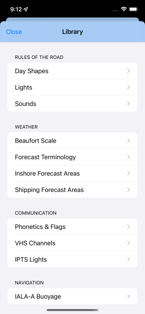
- The Reference Library has been reviewed and brought up to date and expanded with new sections.
- Waypoint File management has been updated for easier import and editing – including:
- Multiple format options for entering coordinates (i.e. DD, DMS and DDM)
- The ability to import .gpx files from within the app.
- Share your .gpx files with others through the standard iOS ShareSheet (i.e. AirDrop, Messages, Mail etc.)
- Share your .gpx files with others through the standard iOS ShareSheet (i.e. AirDrop, Messages, Mail etc.)
- Solent Marks for 2022/2023 are pre-loaded (as .gpx file).
- New option to choose display units for ‘distance’ – see ‘Settings’.
- Responsive technical support.
Minimum OS Version: To provide the best app experience, the minimum OS version required to run the new version will be iOS/iPadOS 15.0
The list of supported devices can be found on Apple’s website here for iOS and here for iPadOS.
Feature Overview

Tides
A 7-day tide table (10 days with enhanced subscription) for 700 standard and secondary UK, Channel Islands, Isle of Man and Republic of Ireland ports. Sunrise and sunset times, along with moon phase, are shown for each port. Tidal curves are available for over 600 ports.
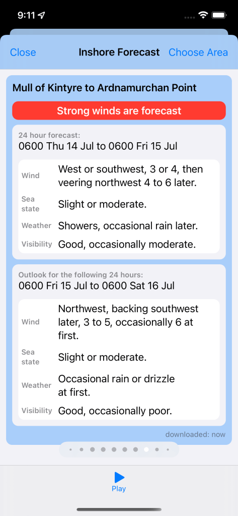

Marine Forecasts & Weather
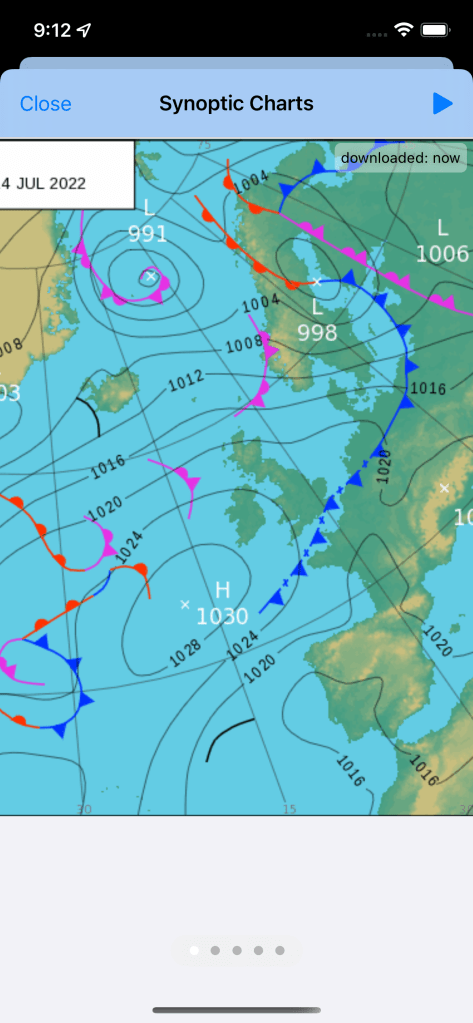
The UK Inshore and Shipping forecasts for all regions are immediately accessible to you – with Synoptic charts for 12 to 84 hours to see the overall picture and developing fronts. The Port screen also shows a 7-day meteogram (10 days with enhanced subscription) of the relevant weather model data.
The Irish Sea Area Forecast and Coastal Report is also available.

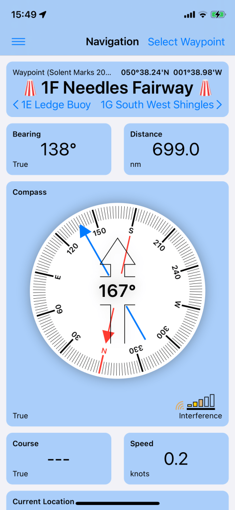
Navigation
See your current position, speed and course (over ground). Save waypoints (or use the built in Solent racing marks) and see the distance and heading to them on the built in compass. Also allows you to import and export waypoints as GPX files.
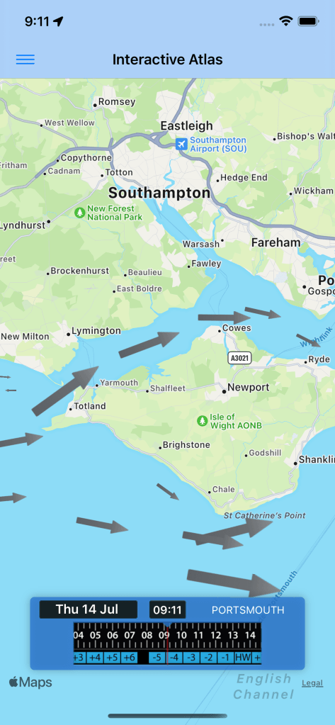

Tidal Streams
An interactive tidal stream atlas showing the principle streams for the UK from Ardnamuchan Point in the west around England and up to Edinburgh in the East.

Built-in reference material
We all learnt much of this for our theory courses – but I have to confess that you’re the better sailor than me if you’d still get 100% when tested. So Boatie includes these reference tables so you’ve got it close to hand either for you or your crew.
- Day shapes
- Light signals
- Sound signals
- Forecast terminology
- International Morse Code
- Inshore forecast areas
- Beaufort scale
- Signal Flags
- Phonetic alphabet
- VHF channel usage
- Emergency VHF Radio Protocols
- IALA buoyage